South Asia Physical Map Quiz
Share


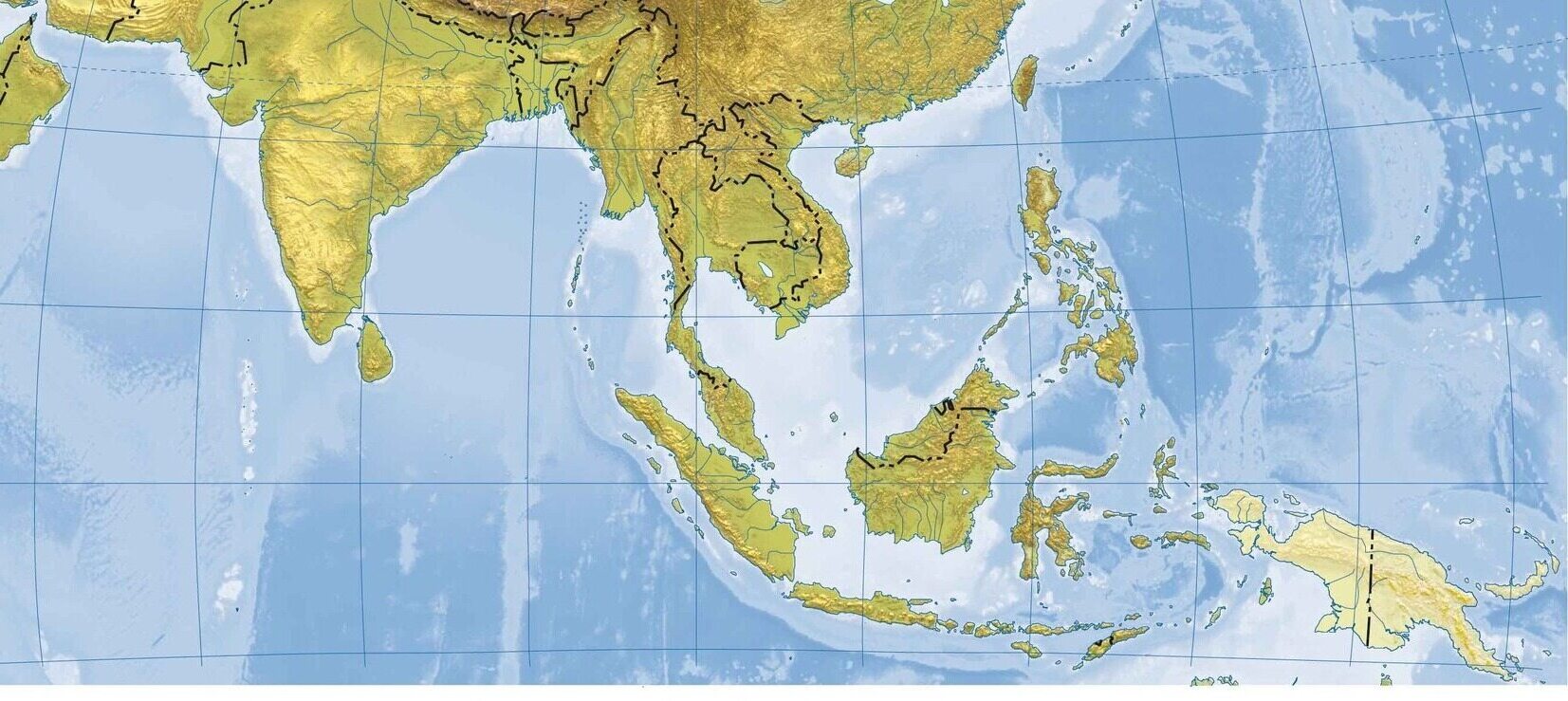
South Asia, a region rich in diverse landscapes and natural beauty, offers a fascinating array of geographical features. From the towering peaks of the Himalayas to the vast plains of the Ganges, this quiz will take you on an exciting journey through the physical map of South Asia. Ready to test your knowledge? Let‘s get started!
We recommend that you do not leave the page that you are taking this quiz in. Stay honest 🙂
South Asia Physical Map Quiz Questions Overview
1. Which mountain range forms the northern boundary of South Asia?
Himalayas
Andes
Rockies
Alps
3. What is the largest desert in South Asia?
Thar Desert
Sahara Desert
Gobi Desert
Kalahari Desert
4. Which plateau is known as the ‘Deccan Traps’ due to its volcanic origin?
Deccan Plateau
Tibetan Plateau
Chota Nagpur Plateau
Malwa Plateau
5. Which river flows through Pakistan and is one of the longest rivers in the world?
Indus River
Ganges River
Brahmaputra River
Yamuna River
6. Which mountain peak is the highest in South Asia?
Mount Everest
K2
Kangchenjunga
Lhotse
7. Which body of water lies to the south of India?
Bay of Bengal
Arabian Sea
Laccadive Sea
Andaman Sea
8. Which island nation lies off the southeastern coast of India?
Sri Lanka
Maldives
Mauritius
Seychelles
9. Which river is known as the ‘Sorrow of Bengal’ due to its frequent flooding?
Brahmaputra River
Ganges River
Meghna River
Padma River
10. Which mountain range runs parallel to the western coast of India?
Western Ghats
Eastern Ghats
Aravalli Range
Satpura Range
We recommend that you do not leave the page that you are taking this quiz in. Stay honest 🙂
Can Your Friends Do Better Than You in This Quiz?
Share this quiz with your friends and compare results.


Was this page helpful?
More Popular Geography Quizzes:
-
 Top Quiz
Europe Quiz
-
 Top Quiz
Kenya Ferry Quiz
-
 Top Quiz
National Parks Quiz
-
 Top Quiz
Geography Quiz
-
 Top Quiz
Caribbean Island Quiz
-
 Top Quiz
Bing Mountains Quiz
More Interesting Quizzes For You:
-
 Top Quiz
ServSafe Quiz
-
 Top Quiz
Fun Trivia Quiz
-
 Top Quiz
Skin Cancer Quiz
-
 Top Quiz
Journey Quiz
-
 Top Quiz
Classic Car Quiz
-
 Top Quiz
NCLEX Quiz