North America is a continent filled with stunning landscapes, rich cultural heritage, and significant historical events. Spanning from the Arctic tundra of Canada to the tropical beaches of Mexico, this continent features diverse geography that has shaped the lives of its inhabitants since ancient times. Major landmarks like the Grand Canyon and Mount Denali draw millions of visitors each year, offering breathtaking views and unique ecosystems. Understanding the map of North America is key to appreciating its vast natural beauty and historical significance.
History of North America's Exploration
The exploration of North America began with indigenous peoples who inhabited the continent for thousands of years. Notable figures such as Christopher Columbus and John Cabot played crucial roles in the European discovery of the continent. Columbus arrived in 1492, while Cabot explored the eastern coast in 1497, paving the way for subsequent waves of European explorers and settlers. These encounters would forever change the demographic and cultural landscape of North America.
Geographic Features of the Continent
North America boasts an array of geographic features, from the towering Rocky Mountains to the sprawling Great Plains. The continent is also home to notable bodies of water, including the Mississippi River, which is one of the longest rivers in the world, flowing over 2,300 miles. Additionally, the Great Lakes, a group of five large freshwater lakes, serve as a crucial water supply and transport route for the region, highlighting the importance of geography in economic development.
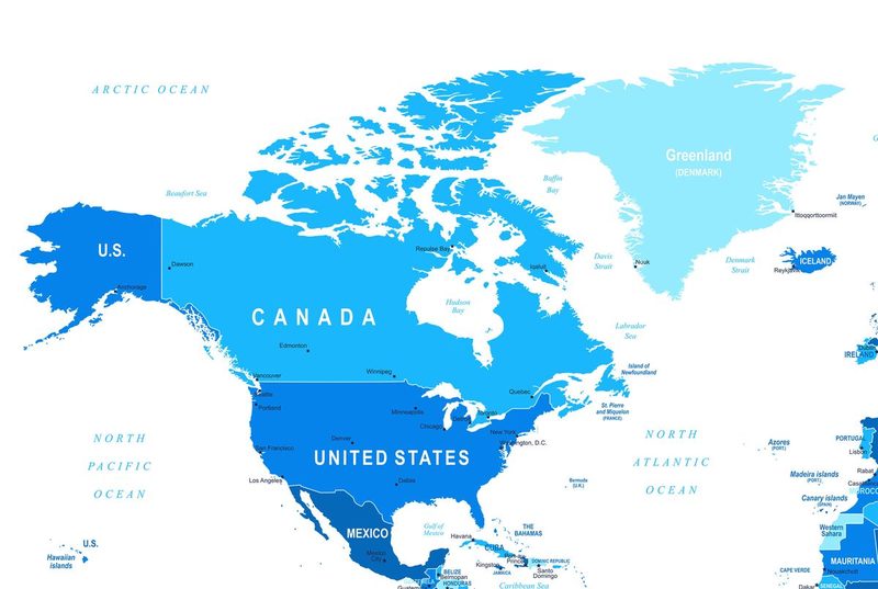
Political Divisions and Capitals
North America comprises three primary countries: the United States, Canada, and Mexico, each with its capital city—Washington, D.C., Ottawa, and Mexico City, respectively. The political boundaries of these countries have evolved through treaties, wars, and negotiations, reflecting the complex history of the continent. Understanding these divisions is essential for grasping the geopolitical landscape of North America.
Challenge yourself with our quiz that covers geographic features, historical events, and political divisions of North America. See how well you can navigate the map of this diverse continent!
No comments yet. Be the first!